
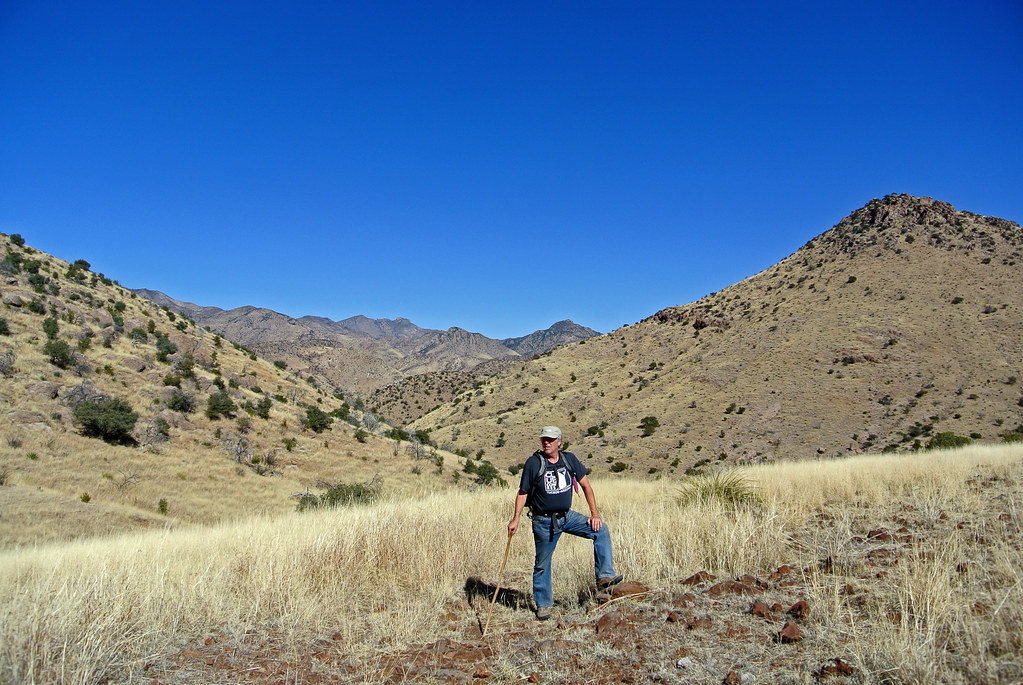
Yesterday, we took a 16.5 mile hike from our doorstep back through Horseshoe Canyon, then to the south and back out of the mountains through Jackwood Canyon.
Strangely, though it is so close, we’ve never been through Jackwood Canyon. I suspect that the gate into it from 80 is usually locked but I need to verify this. At any rate, it was a very beautiful hike.
You might remember that we did another long “from our house” hike in preparation for the Grand Canyon. That one ended up being mostly off trail (there supposedly was a trail but it was so seldom used as to be gone) and was very difficult as a result. Looking the maps, you never really know whether a trail will be there or not, and our area is remote enough that many trails have disappeared over the years. This time though we were pleasantly surprised to have a good trail for the entire trip. Much nicer!
We started off from our house and went back into Horseshoe Canyon, a hike we’ve done many times. About 7 miles from our house (5 miles into the canyon), there is an old homestead house. About a half mile past that, there is a branch of the trail/road that goes to the south. This goes to Jackwood Canyon.
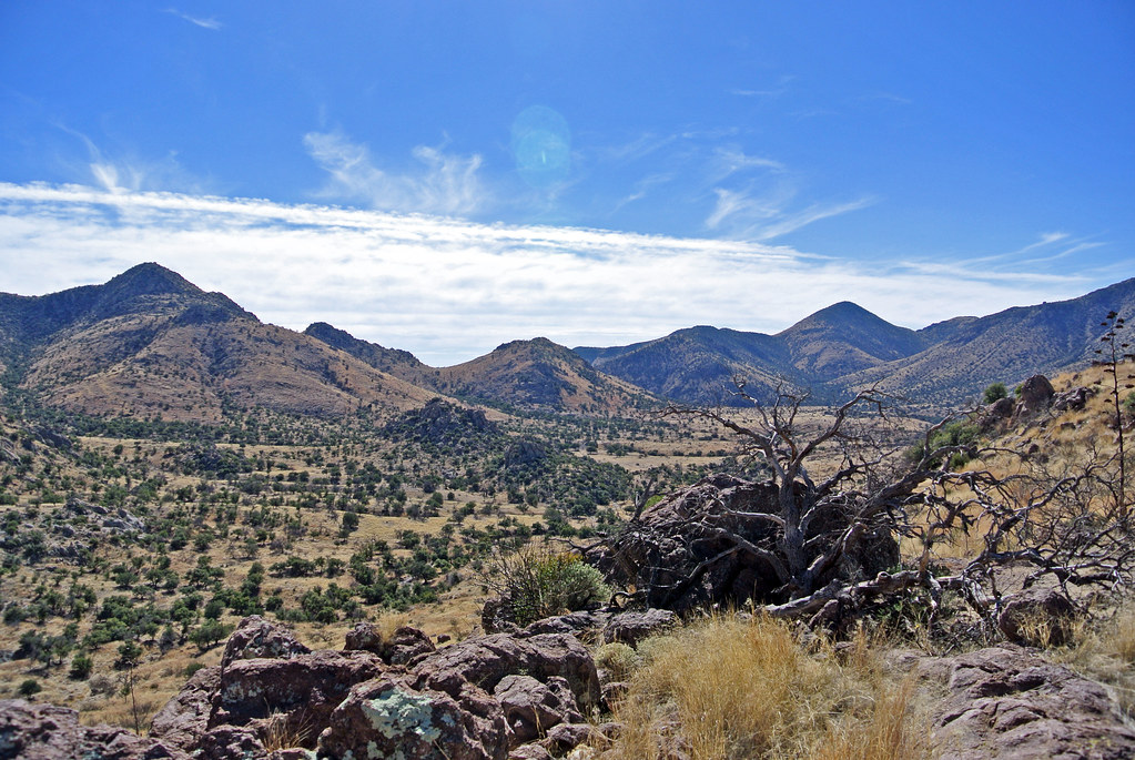
Much of the hike followed an old forest service road. While most of it would not be passable even with 4 wheel drive, it was perfect for hiking. The trail/road went south through some beautiful grasslands. It wove behind the mountains and eventually cut through a pass, so there wasn’t even a huge climb.
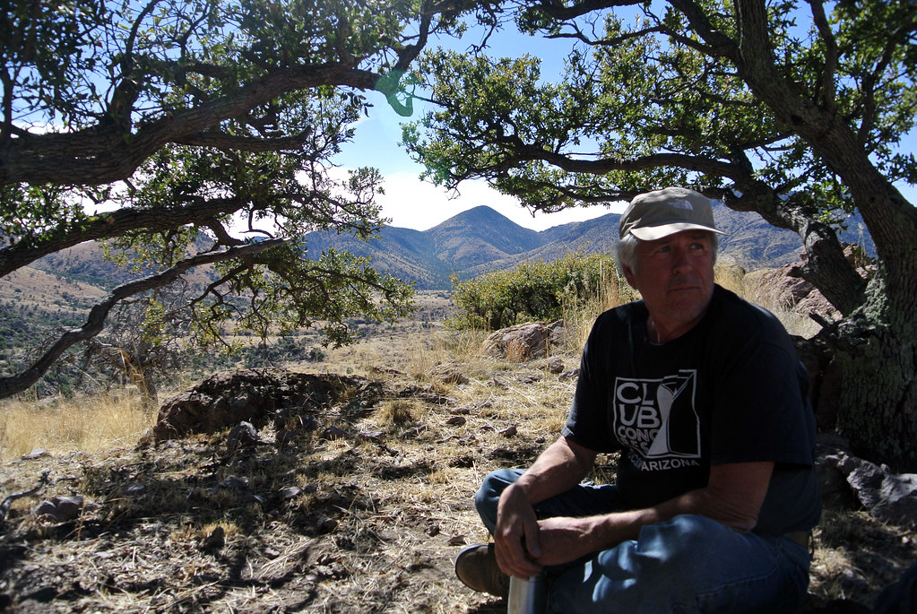
lunch
We almost made it the whole way without seeing a soul, but about three miles from the end, we were approached by a pickup driven by an old cowboy. He stopped, and we said hi. He started out with a look of deep suspicion on his face (the normal expression here when regarding “strangers”). As we told him where we hiked and where he lived, his expression changed to looking as though he thought we were a bit crazy. Eventually, by the end of our conversation, he had a slight smile and seemed to think we were ok. He proclaimed us “quite fit” and wished us well.
We finished the hike in Apache, where we’d left a car. That’s about 6 miles on Highway 80 to Sunrise.
Oh, and there were lots of cows in Horseshoe.
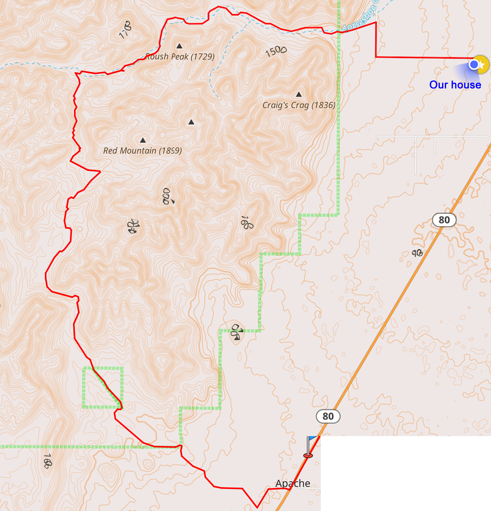
Here’s a map of the hike.
“Quite fit” sounds good. How much of a day does 16 miles require?
I have to assume that you have been to the top of Craig’s Crag at least once since it is the closest peak to your house.
Do you know who “Craig” is, a famous local pioneer perhaps?
–Algot
We left at about 9am and got in before 4. Ample breaks along the way.
I don’t think we’ve been to the top of Craig’s Crag (and this map is the first I’ve even heard that name). I know a Craig here but don’t think this was named for him. :)
I went to a summer camp in Buena Vista, Colorado for four teenage summers. In the range behind the camp, one of the minor peaks was affectionately known as “Cap’s Cap” after the camp’s director, at least in the camp.
It always makes me wonder who gets to name mountains, in particular. I’m reading a book in which it is noted that Alaska’s Mount McKinley is now officially known as Denali after some legislative vote.